Highbourne Cay to Great Stirrup Cay
—Blogpost written by Bob
Highbourne Cay to Rose Island
Just after I crawled out of the v-berth at 6 AM on Tuesday, April 21, a wave crashed over the foredeck and into the overhead hatch and soaked the v-berth bedding—I just escaped it soaking me too. This is how today started for me while still at anchor. We didn’t get much sleep last night because of all the boat motion. I never though it would be as rough as it was. We got underway at 8 AM because we understood that the wind would lighten up as the day progressed.
As we started out the 15-knot wind out of the southwest was hitting us straight on and we could only do about 4-1/2 knots until we turned toward our second waypoint. The second waypoint was a little off the wind and as the morning progressed the wind lightened to the point where we could do 5-1/2 to 6 knots.
We arrived at our second waypoint at noon and we finally doing 6.4 knots! For the third waypoint, we turned north and the wind was pretty much behind us but the sea state was still unsettled. Our speed improved to only 6.4 knots.
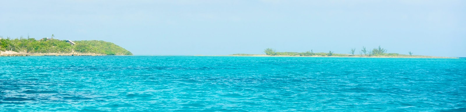
 |
| Heading north from our second waypoint of the day. |
We anchored in the south side of Rose Island, just east of Nassau, at 3 PM. We were the only boat in a beautiful anchorage. We took showers in the cockpit and, then, had Happy Hour drinks (coconut rum and low-carb orange juice). At any other time than during a pandemic like now, this island would have lots of tourists from shore-side excursions offered by all the cruise ships.
Rose Island is approximately 9.3 nautical miles long and only 0.4 nautical mile wide at its widest point. We saw two buildings on the island that could have been homes.
 |
| Rose Island is on the left while a small nearby island (right) is at the end of our anchorage. |
After Happy Hour I transferred diesel fuel from our auxiliary tank to our primary tank. We put about 26 hours on our engine since leaving Emerald Bay Marina which equates to about 15.6 gallons of fuel. Our auxiliary tank holds 19 gallons and nearly all of it was transferred to our primary fuel tank. We expect to put 16.67 hours on our engine over the next 2 days (10 gallons)—so, the primary tank as it sits should be fine until we refuel after 2 more days of travel.
As we motored today, Maggie and I agreed that we’ve had enough adventure (cruising) but then we are rewarded by this beautiful anchorage and a nice cool breeze. We might actually get a good sleep tonight.
We also discussed the possibility of making a nighttime Gulf Stream crossing simply by leaving Port Lucaya about 6 PM (with enough light to get out on the channel) and motoring all the way to Fort Pierce. This would get us to Fort Pierce Inlet sometime in early Saturday morning (about 8 AM).
Rose island to Great Stirrup Cay
We began our fourth day of our fast track back to the U.S. at 6:45 AM on Wednesday, April 24. We both got a great night’s sleep last night with a nice cool breeze out of the north and very little boat motion.
 |
| Just before sunrise at Rose Island. |
As we motored out from the southeast end of Rose Island, there was up to 1 knot of tidal current against us between the small outlying large rocks—it could be seen on the water’s surface. I used waypoints that I input last night because there’s no way I could have seen coral heads at 6:45 AM. As we got out beyond the large rocks on the eastern end of Rose Island, we started our course toward Petit Cay in the Berry Islands—it was 8+ hours away.
 |
| When Lola need to feel more secure she comes to me. |
We could still see the high-rise hotels of Nassau 3 hours into our day’s trip. As we passed one point in the Tongue of the Ocean, the body of water we were crossing, the depth was 9,000 feet! We could only tell by our electronic charts because the depth sounder stops working after a couple hundred feet.
Maggie discovered that the lid on a jar of mayonnaise came off while in the fridge—the mayonnaise was on some ice cubes and other things in the fridge. She spent an hour cleaning it up.
About 1/2 way into our trip (about 4+ hours to go) the wind and tidal current lightened (as well as the fact that the sea state improved) and allowed our boat speed to be increased to 6.5 knots (at 2300 engine RPM) pretty consistently.
At 12:30 PM we could see the Berry Islands to our port, specifically Bond’s Cay, Adler’s Cay, Frozen Cay, and others. We still had a little over 2 hours to go until we got to the next to the last waypoint at Petit Cay. By this time the sea state improved (to less than 1 foot) and so did our boat speed (to 6.7+ knots).
We were surprised at the number of homes we saw along the beach on Great Harbour Cay, maybe two dozen.
We anchored at 4:15 PM in Great Stirrup Harbour in 16 feet of water. We dropped the anchor in a sandy spot among a mostly grass bottom. We immediately put up our sunshade since the afternoon sun was very intense. At this spot we are slightly exposed to the east but tomorrow’s wind is supposed to be from the southeast—let’s hope the wind understands. We installed the anchor bridle in case we see high winds from the east early tomorrow morning.
----------
Tomorrow, we are on to Port Lucaya where we will refuel and head back to the U.S. It is expected to be a rough day and then a very long night...
Stay healthy and thanks for following our blog!
No comments:
Post a Comment