2016 Month-long Sailing Trip - Part 3
--Blogpost written by Bob
On our way out of Back Creek in the Solomons after adding fuel (13.5 gallons) and water, another sailboat was being helped by TowBoatUS. They were removing the floatation bags when we arrived. I'm not sure if the boat was taking on water or what was going on but it the first time I have ever seen this remedy for a boat in distress.
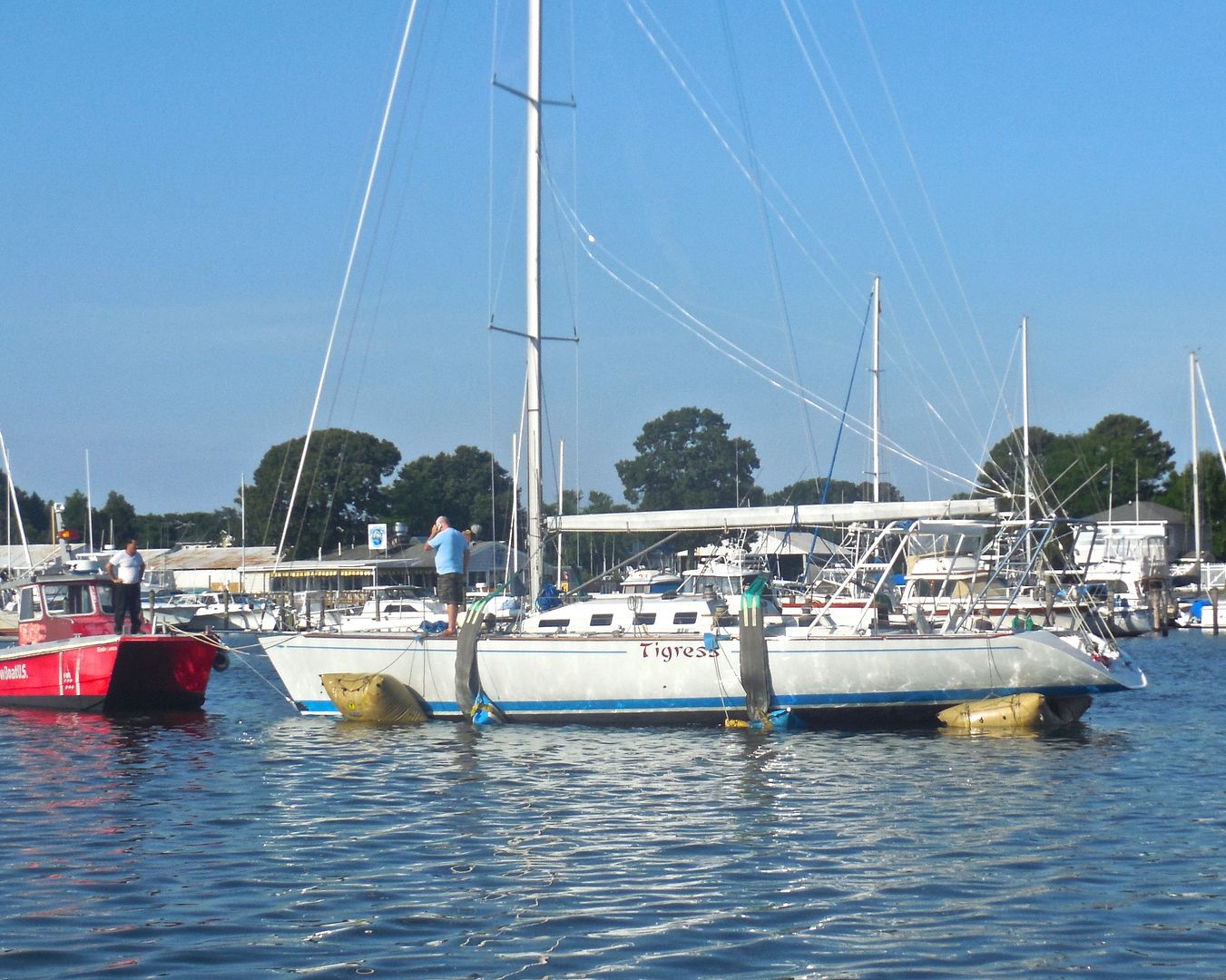 |
| TowBoatUS was standing by as the floatation bags were being removed from this sailboat. The guy on the foredeck (I assume the owner) was using his cell phone. |
The remainder of this blogpost is dedicated to our two-day visit to one of the most remote islands in the Chesapeake Bay, Tangier Island, Virginia.
Monday, June 27
It was a very long (7 hours) motor trip from Solomons to Tangier Island. The wind was on our nose the entire trip & we didn't want to make an intermediate stop. We arrived at Park's Marina on Tangier Island at about 3:30 PM. The tidal current running through the cut was swift and made docking very difficult. Fortunately, we got there early enough to get a t-head dock right in front of the marina office. Three other boats arrived after us.
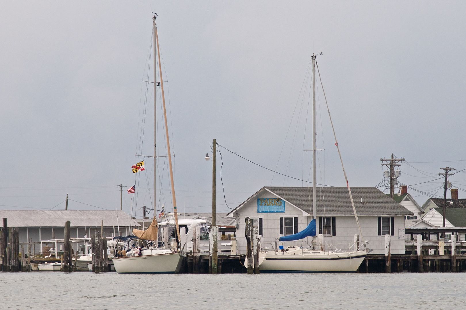 |
| Rainy Days is the boat on the left side of this image. The Chesapeake Bay Guide states that there are 25 slips available at Park's Marina. However, work boats use some of the slips and others have silted in, leaving only a half dozen or so available for deep draft sailboats. We had at least 10 feet of water at the t-head. |
 |
| There was no WiFi nor cellular service available on the island. We did have electrical power and it was absolutely luxurious running our onboard air conditioner during the night. |
We took a short walk along Ridge Road and stopped for dinner at Fisherman's Corner just before they closed at 6 PM--yes, they CLOSED at 6 PM! We had very tasty crab bisque soup and crab cakes. Food wasn't any cheaper here than in Annapolis but it may have been a little fresher.
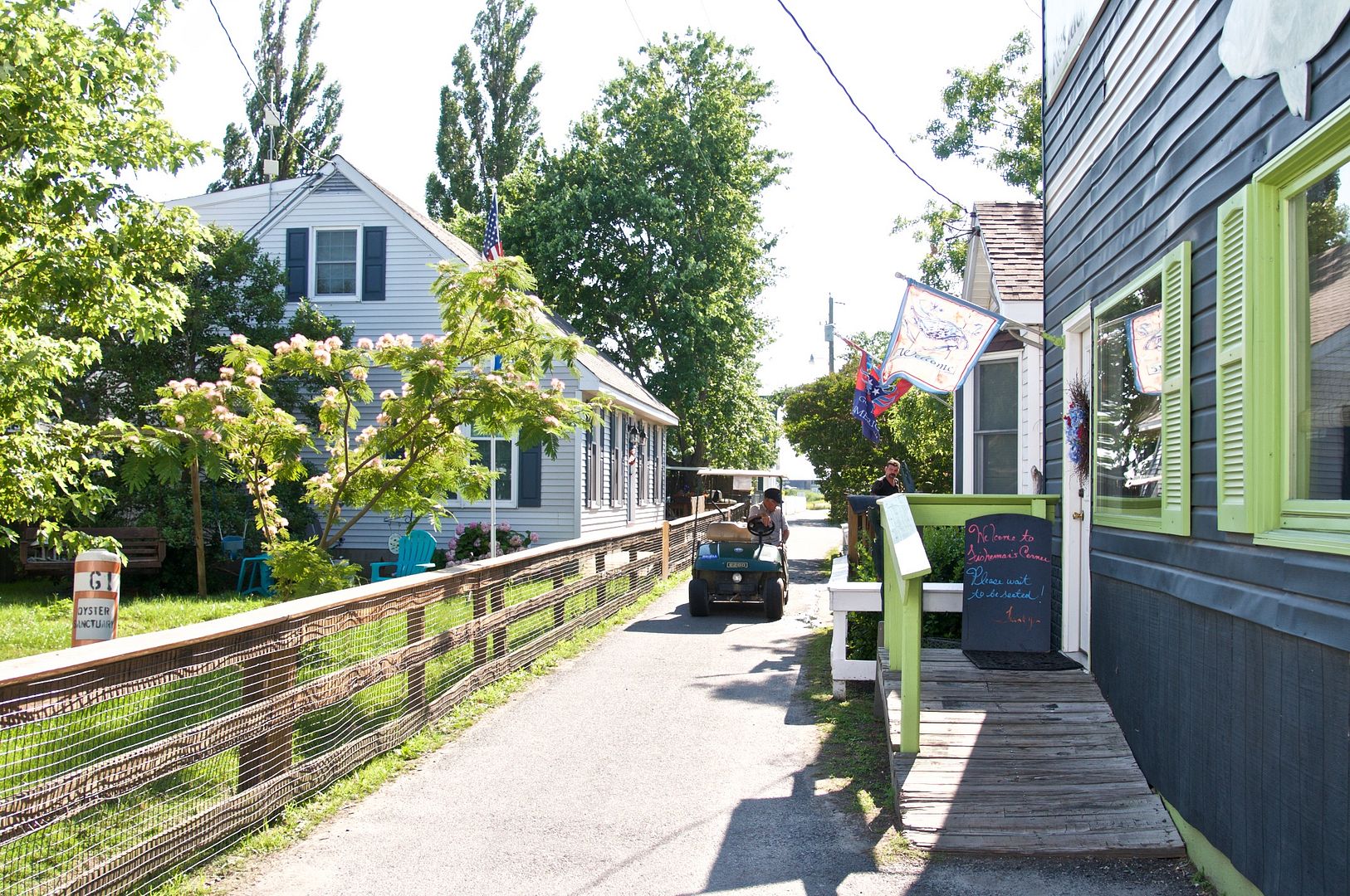 |
| A resident's golf cart is driven on a side street next to Fisherman's Corner Restaurant. |
Residents drive golf carts or mopeds to get around the island. We saw a few pick up trucks but there is no car ferry service to the island and most of the roads are not wide enough for normal cars or pick up trucks. Big items that won't fit on the mailboat, like vehicles, are brought from Crisfield by barge.
People seem very friendly on Tangier Island. Everyone who came by on a workboat waved to us while we were tied up at Park's Marina. Visitors are probably less common here than most other places on the Chesapeake Bay. There are several tour boats (from Reedville, Onancock, and Crisfield) that make regularly scheduled trips in season.
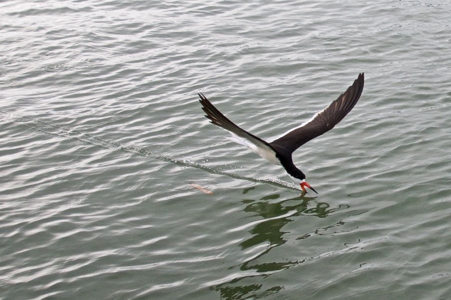 |
| During the evening, black skimmers would come very close to our boat to feed on small fish on the surface of the water. They fly with their lower beak in the water to scoop up small fish, leaving a trail in the water. |
Tuesday, June 28
It rained during the night. I took my camera for a walk in the early morning to capture the images below.
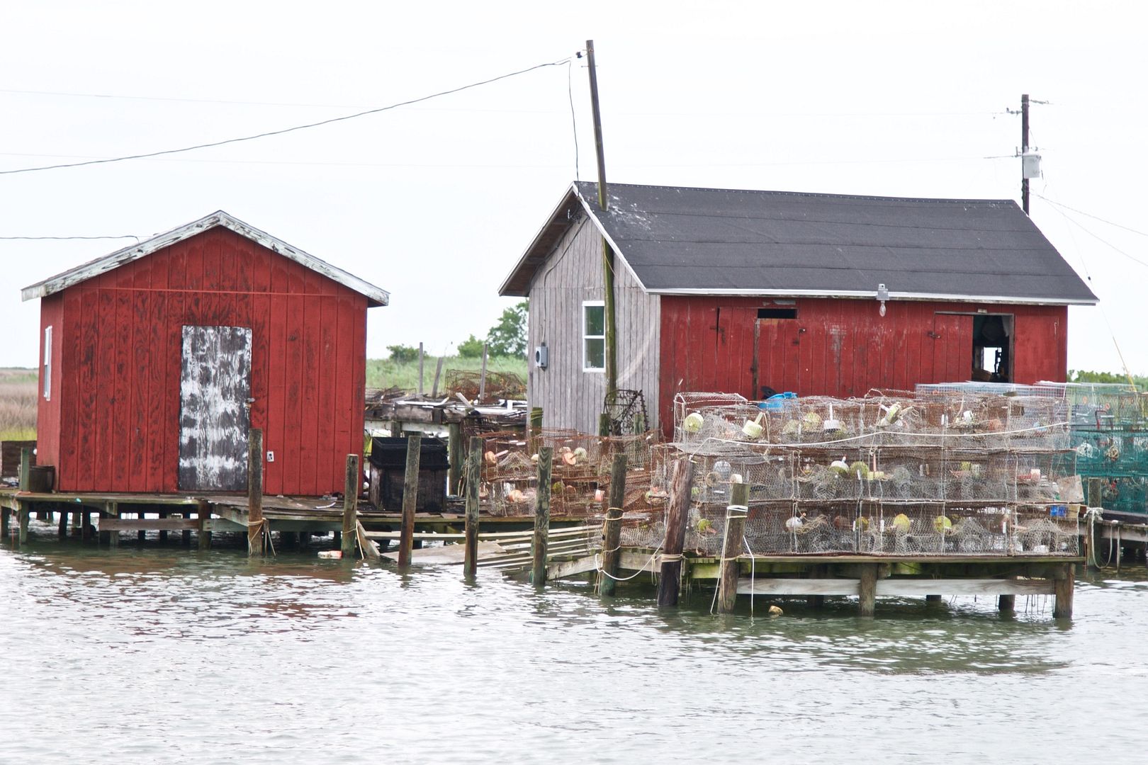 |
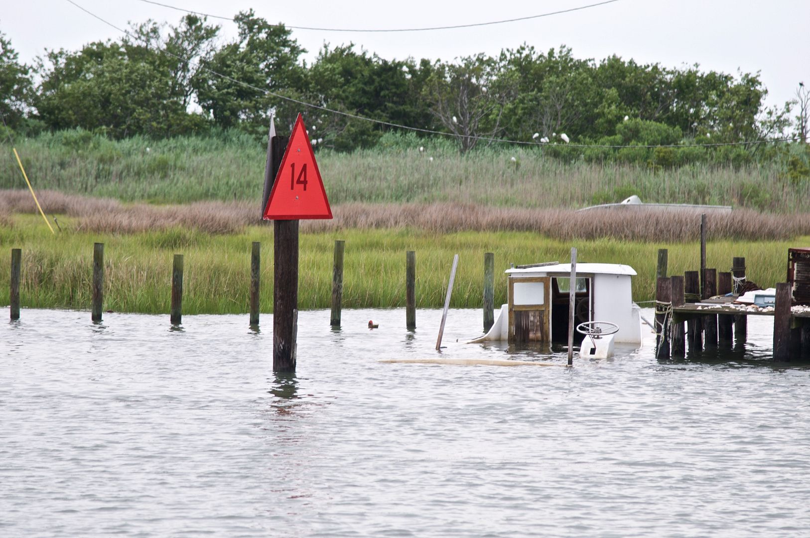
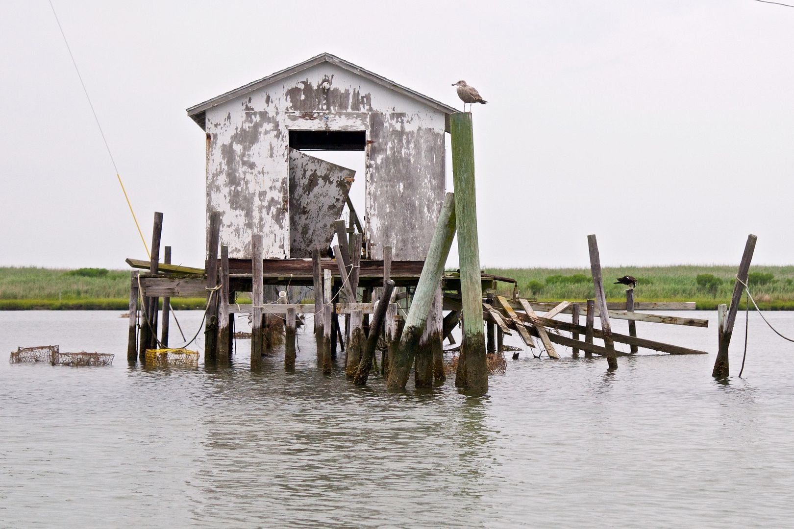
| These crab sheds are north of the cut. Five hundred people used to live north of the cut, an area called "upphards" and there used to be a bridge across the cut. Today, no one lives north of the cut and the bridge is only a memory. |
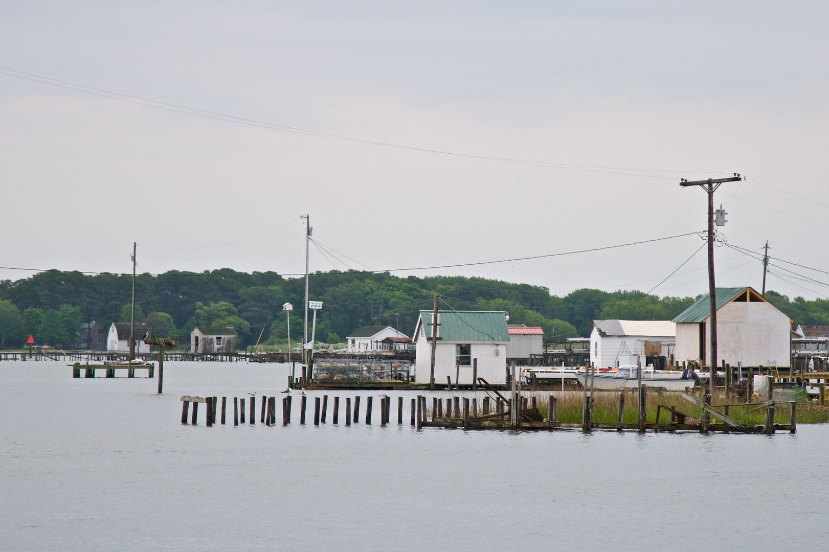 |
| I think this image shows the beautiful isolation of this island. |
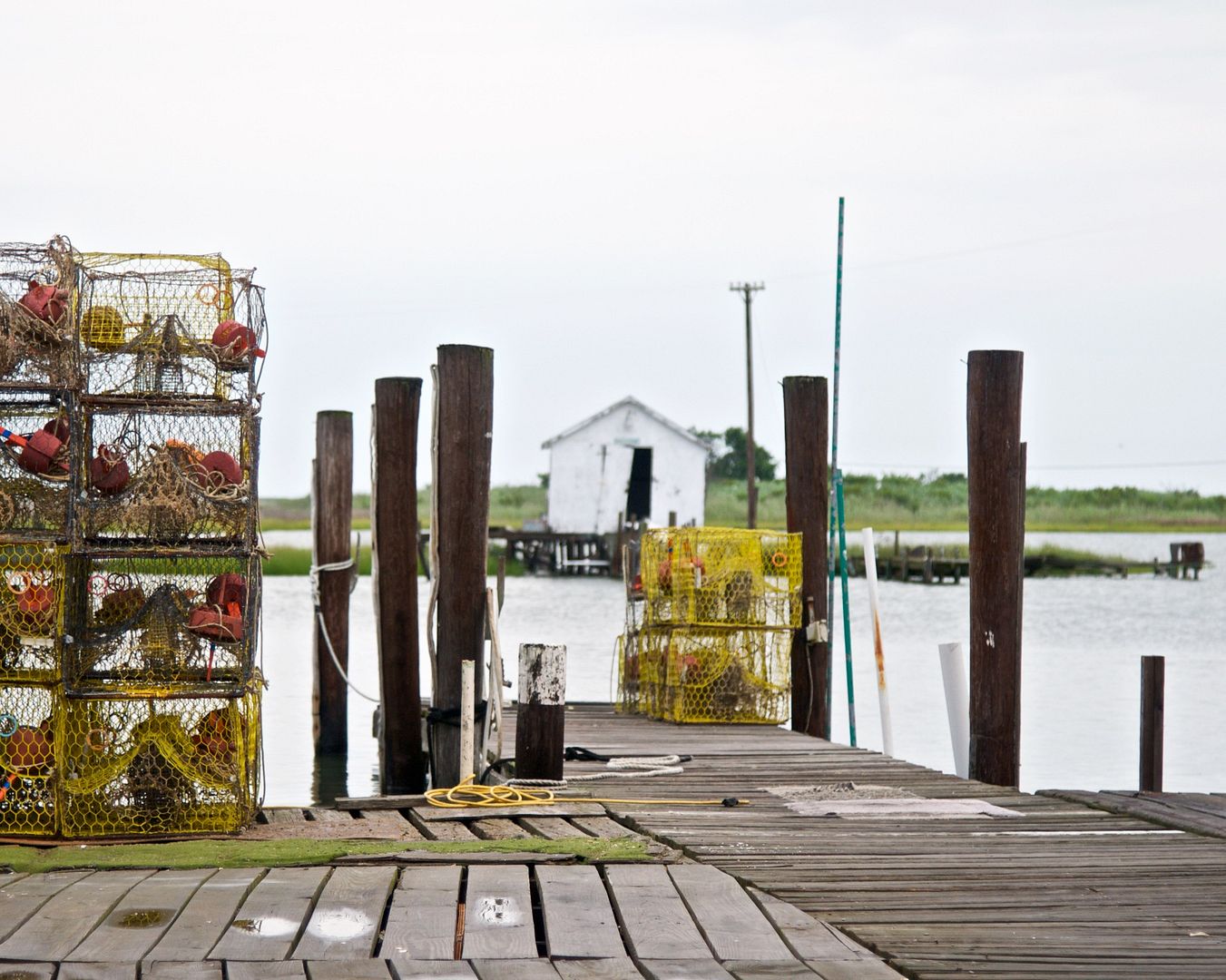 |
| This is a dock on the southern side of the cut where crab traps are stored and waterman's boats come in to dock. |
 |
| This gives a whole new meaning to shallow draft vessel. |
We rented a golf cart for an hour and drove around Tangier Island. (An hour is plenty of time to explore the roads of this island.) On this overcast day, there is not much difference in color between the water and the sky.
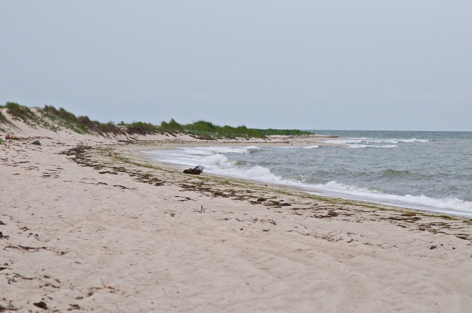 |
| We drove our rented golf cart to the beach on the southernmost point of Tangier Island. The sand was very light and fluffy where it wasn't wet and the water was very clean. |
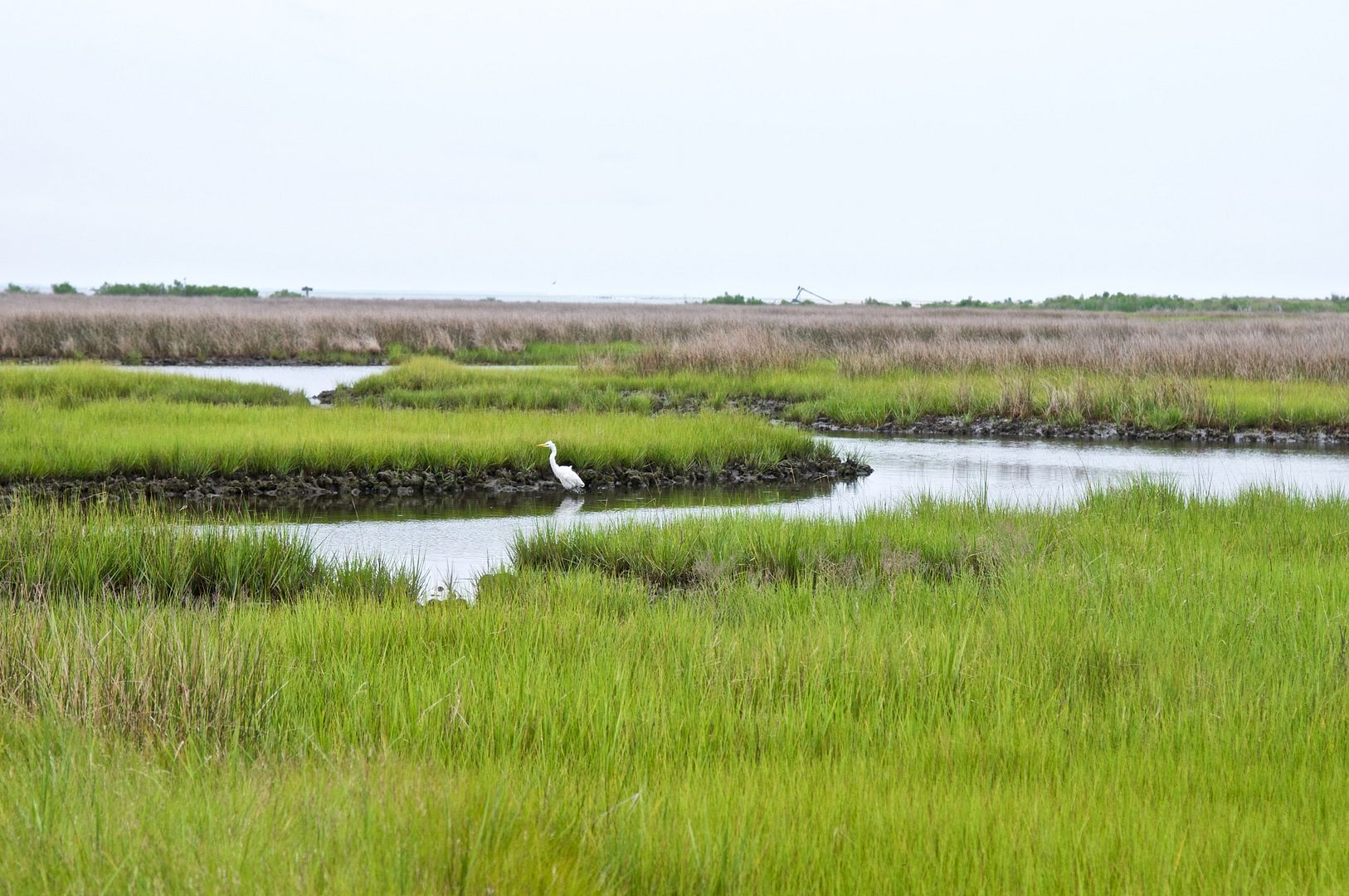 |
| Much of Tangier Island looks like this photograph with tidal waterways that meander all over the wetlands. |
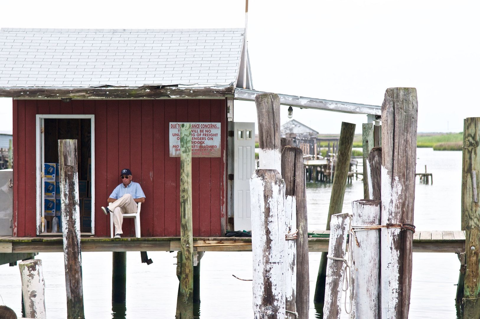 |
| This old man was just sitting on the side of his crab shed passing time. |
Around mid-afternoon, I scooped all the rainwater out of the dinghy and we went for a ride around the cut and took the following photographs:
 |
| There are a lot of crab sheds on the northern side of the cut that look like this one--like they haven't been used in years. |
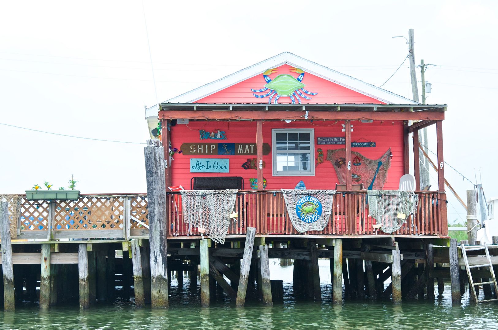 |
| We think this is actually a house built on poles along the cut. It is the most colorful building on the island. |
 |
| Even though you can't tell from this photograph, the tidal current in the cut is quite strong at times--we used spring lines fore and aft to maintain our position as the tide changed level. We are planning to leave at high tide tomorrow morning when the current is not so strong and we have maximum water depth. |
Summary
At the rate of erosion being experienced on Tangier Island, it is estimated that this island could disappear by 2050. National Geographic placed Tangier Island (and Smith Island) in 2016 Best of the World List in terms of "must see" places.
We are progressing further south in the Chesapeake Bay as shown on the following map.
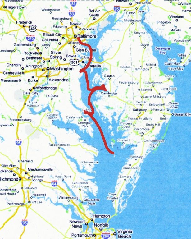 |
| As indicated by the red line, we are now at Tangier Island, Virginia. |
Stay tuned as we head from here to Onancock on Virginia's eastern shore.
Thanks for following our blog!
No comments:
Post a Comment